Getting Out in NYC - 6 Trails to Explore

This list offers outdoor escapes from Manhattan Island, for those seeking trails to run or hike on...
Our six trail recommendations for the weekend-warrior hiker inspiration around the Big Apple. Lace up a pair of hiking boots that can handle mixed terrain and get started!
Sourland Mountain Preserve Loop
•Roundtrip Distance: 5.4-mile // Elevation Gain: 530 feet (apprx.)
An hour-and-a-half drive from Manhattan via Interstate 78W and 287S, the 3,000-acre Sourland Mountain Preserve is home to two boulderfields, known as Devil’s Half Acre and the Roaring Rocks, along with multiple trails and boardwalks to explore. The main 5.4-mile loop trail is flagged with white square blazes and numbered markers, with plenty of intersecting trails that can be added to shorten, or add length or variation to the route.
The trailhead is located at 415 East Mountain Road in Hillsborough, NJ.
Cushetunk Trail at Round Valley Recreation Area
•Roundtrip Distance: 12.2 miles // Elevation Gain: 1,745 feet
Outlining the deepest man-made lake in the state of New Jersey—sometimes referred to as the Bermuda Triangle of the state—the Cushetunk Trail at Round Valley Recreation Area is a 12-mile, loop trail through both open and wooded areas, with sections that rise over moderately steep grades. Round Valley Recreation area is the state’s only park that offers wilderness camping, with sites located on the lower trail and running along the reservoir. Camping can also be accessed by paddlers via the reservoir. Round Valley is an hour ride from Manhattan via I-78 west to exit 20A. Continue on Route 22 west and follow signs to the park
To access the Cushetunk Trail, start at the south parking area, walk up the hill toward the trailhead on the left. The Cushetunk Trail is blazed with red-tipped poles and offers a gentle start with views of the reservoir between wooded areas. As you venture further, the terrain becomes more varied, followed by an opening where the dam is located. The trail eventually splits, and if you bear left to the lower trail it declines toward the campgrounds that can be used to reach the shore line of the reservoir. Bearing right at the fork will keep you on the upper Cushetunk Trail. The upper trail connects to the lower trail after a few miles, thus providing the option for a shorter hike if desired; hike to the second intersection and take the camp trail back toward the first intersection and then follow the Cushetunk Trail back to the parking lot.

Oslo Rock and Tourne Mountain’s Stone Living Room
•Roundtrip Distance: 2.1 miles // Elevation Gain: 616 feet
Approximately an hour from Manhattan and located in West Milford, NJ, the Norvin Green State Forest is home to multiple trail routes, including one leading to Oslo Rock and Stone Living Room, a group of stone chairs circling a large stone fire pit. Over the years it has been destroyed and rebuilt, but it remains a scenic point of interest nonetheless. As the shortest hike of the area, the round trip to the Stone Living Room is just over two miles, featuring mostly rocky terrain with wooded areas on the slope of Tourne Mountain and in the ravine before Oslo Rock.
The parking entrance is off of Glenwild Avenue in Bloomingdale, NJ. If heading west on Glenwild, park at the first parking area on the right. Follow the Hewitt Butler Trail (blue blaze) across the street and take the south trail up Tourne Mountain. The Stone Living Room is off the trail toward the left. Enjoy the various vantage points from the ledges surrounding the stone structures before heading toward Oslo Rock for full 360-degree panoramic. Return via the blue path toward the trailhead.

Ramapo Park Lake Loop
•Roundtrip Distance: 6.8 miles // Elevation Gain: 830 feet
Popular for its hiking and biking potential, Ramapo State Park abundant wildlife and flora add extra appeal to this State Park outdoor destination. An hour’s drive from the city, this “loop” is more of a double-lollipop that travels the perimeter of the namesake lake, following a moderate grade. Great for trail running, hiking and dog friendly (on leashes)!
While you’re in the park, head up the 3.2-mile out-and-back trail to visit the Van Slyke Castle Ruins, and catch a view of the NYC skyline. This route starts at the Skyline Divide trailhead on the blue-blazed MacEvoy Trail. Once on McEvoy, follow until you reach the Castle trail (white blazes) where just a short, but steep, climb remains to reach the ruins and overlook.
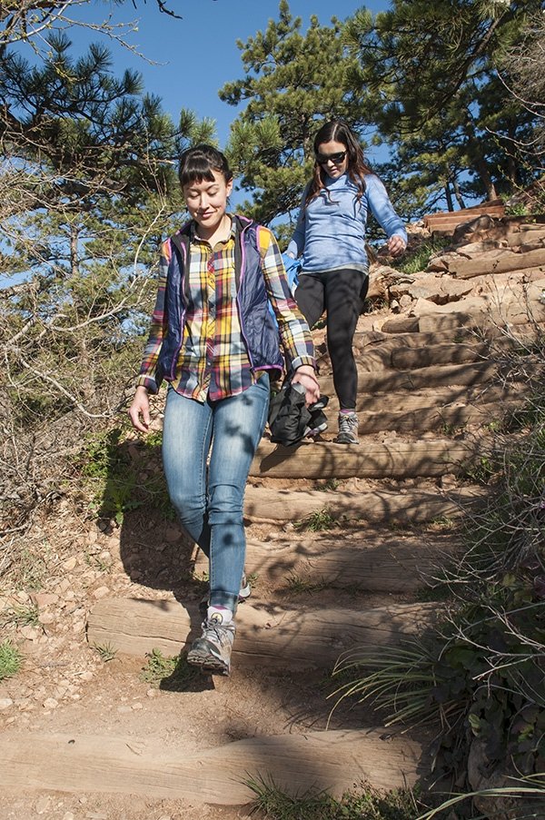
The FC 4.1 is an eco-friendly, waterproof hiking boot whose flexibility and ankle stability make it incredibly versatile and suitable for any of the trails below.
Twin Mountain
•Roundtrip Distance: 6.0 miles // Elevation Gain: 1,758 feet
A little further from the city (about 2.5-hour drive), but certainly worth a weekend trip, Twin Mountain offers a 6.0-mile trail that takes hikers to its two, slightly staggered summits in the Catskills. The trailhead is located off Prediger Road in Elka Park, N.Y—about two and a half hours from NYC.
From the trailhead, follow the Jimmy Dolan Notch Trail through gradually rising gradients that cross evergreen forests and a wooded area, until you reach a steep climb. This will bring you to the intersection with Devil’s Path: a lean-to can be found straight ahead while a right onto Devil’s Path (marked with red blazes) will begin the ascent to Twin Mountain. The trail to the summit has various ledges for snapping photos of the views below, while the (true) summit shows gorgeous panoramic views of the Catskills

Whiteface Mountain
•Roundtrip Distance: 9.4 miles // Elevation Gain: 3,599 feet
One of the best hikes, suited for a weekend trip away from New York City, requires noteworthy preparation as it presents challenging grade over rugged terrain. Located four hours outside of New York city in Wilmington, NY, Whiteface Mountain is the older and more popular sibling of Cascade Mountain. The fifth highest mountain in New York at 4,865 feet, Whiteface gained notoriety after hosting alpine skiing during the 1980 Winter Olympics.
From the Wilmington trailhead, descend for the first few legs until you begin to gain elevation, ascending Marble Mountain. The summit of Marble Mountain is actually an intersection, from here, take the right split and follow the steeply ascending trail over Ester Mountain. Follow this path to the summit of Whiteface (4,867’) where you’ll find 360-degree views of New York State, Vermont, and possibly a few other scenic view seekers, as there is also a road to the summit.
Best of luck and enjoy the views.
Originally written for La Sportiva by RootsRated.
Photos Provided by La Sportiva and RootsRated.


